I think a great way to understand the importance of community maps and participatory map making in general is to first understand its relational and political nature. For instance, did you know that community mapping has been banned in Malaysia? This followed a landmark court victory where a community made village map was the key piece of evidence used to prove customary rights of communities living in Rumah Nor! (for more please see http://www.nativemaps.org/node/1715)
How did this kind of map-making, which involved a piece of paper, a few sketch pens and possibly some help from satellite imagery become so powerful that it elicited such a response? This question prompted me to do a little research and I found a brilliant book called ‘Rethinking the power of Maps’ by Denis Wood, which helped shed a little light on the subject. The following section is informed primarily by his insights on the subject.
What are maps?
Although unaware of a definition, all that I knew about maps were that it was used to show where things are (recalling what I had learnt in school!). That is, it represented what was in an area spatially and was sorted based on particular themes (political maps show states and capitals, physical maps show natural features).
This seems to be in line with common understandings of maps if we take into account figure 1 which is a ‘word cloud’ generated using Jonathan Feinberg’s ‘wordle’ algorithm, out of all the words in the 321 definitions of the word ‘map’ collected from 1649 to 1996 (definitions compiled by J.H. Andrews, see Andrews 1996, also see http://makingmaps.net/2008/11/25/321-definitions-of-map/ and http://www.wordle.net/).
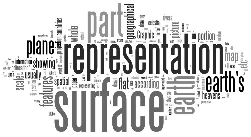
The size of each word is proportional to its frequency in the collection of definitions.
So according to most definitions, maps represent the earth’s surface. But does it really? Wood (2010) begs to differ. Through a histographical analysis he notes that the rise in the importance of maps in newly forming states was because officials began to realize that maps helped in giving form to the state. That is, maps had the ability to help construct the state. Talking about the reason behind newly forming states fascination with maps he comments (2010: 33)-
‘…it certainly cant be the maps putative ability to ‘represent a part of the earth’s surface’. After all, it was the maps that conjured up borders where none had existed (especially well documented for the United States, Russia and Thailand); the maps that summoned unity from chaos (like Japan and Russia); the maps that enrobed the shapeless(as in the case of China)…maps that endowed with form what from the beginning had been no more than a dream… “We no more show what exists” said the maps(even today they say this about the borders of India and Pakistan, Israel and Palestine, India and China). What maps thereby avoided saying was, “Exists, yes, but only on these maps which, in fact create and affirm their existence,”…maps created and affirmed their own existence, most effectively by hiding their own recent origins…in the state itself’.
From this analysis thinking of maps as merely representations of the earth’s surface is specious. Instead, we need to ask ourselves whose ‘surface’ do most maps represent?
For example, we are familiar with this map of Australia-

Map 1- Political map of Australia
However, how many of us have seen this one?
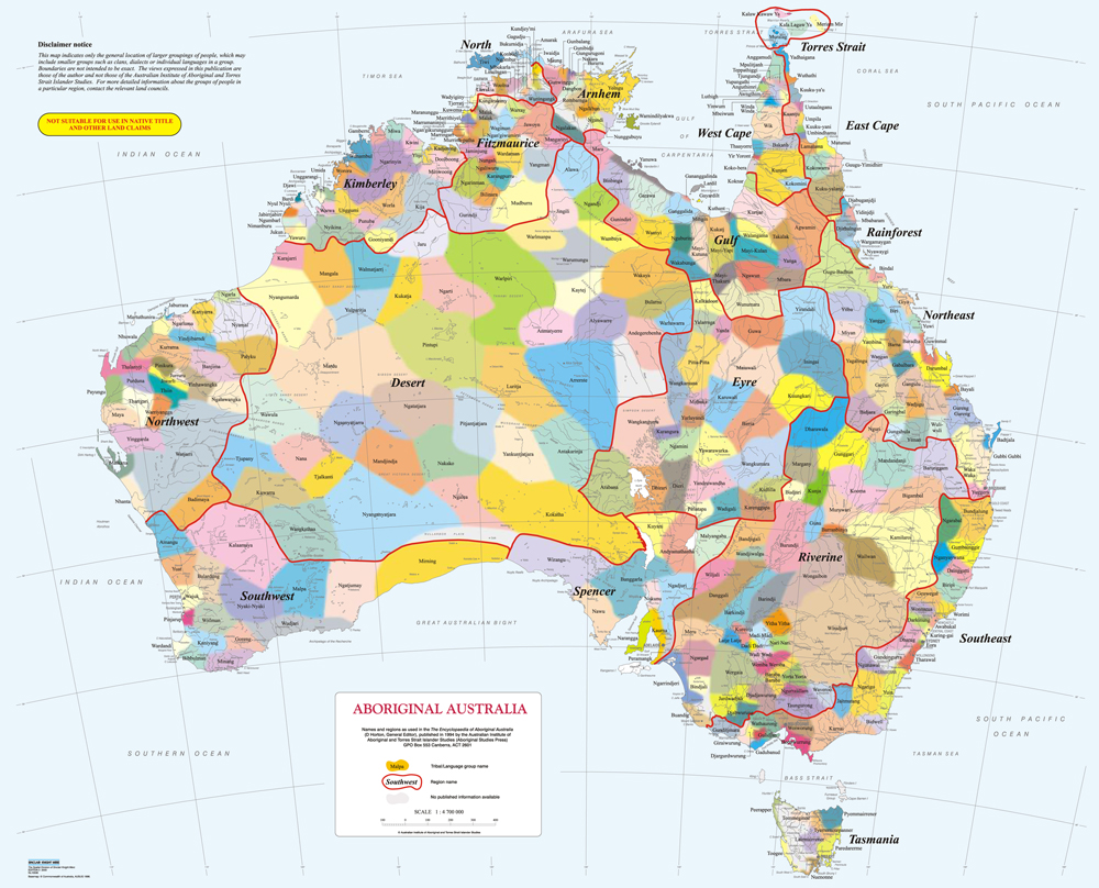
Map 2-Aboriginal Territories of Australia.
Is Melbourne really in Victoria or somewhere in between a mesh of aboriginal territories?
Do the smooth lines and clear demarcations of the political map negate the squiggly lines that define the age-old territorial formations of the original inhabitants?
The answer is most likely yes (unless you are an aboriginal inhabitant!).
Thus one needs to consider the power of maps in reaffirming the hegemonic beliefs in a region. This is true even for user-generated maps like google! After all, before someone can begin plotting away on a google map isn’t it a precondition for that person to be Internet saavy? However, what is also clear in the case of Rumah Nor is that the power of maps can also be used to affirm the presence of alternate subaltern realities (which is precisely what the officials in Malaysia seek to deny!). For an amazing initiative in this vein see www.nativemaps.org.
Maps need to be viewed with a healthy skepticism that allows the map viewer to move past the common misconception that maps are representations and into a realm where the viewer is aware that what maps ‘represent’ is mostly in thrall of the dominant interests.
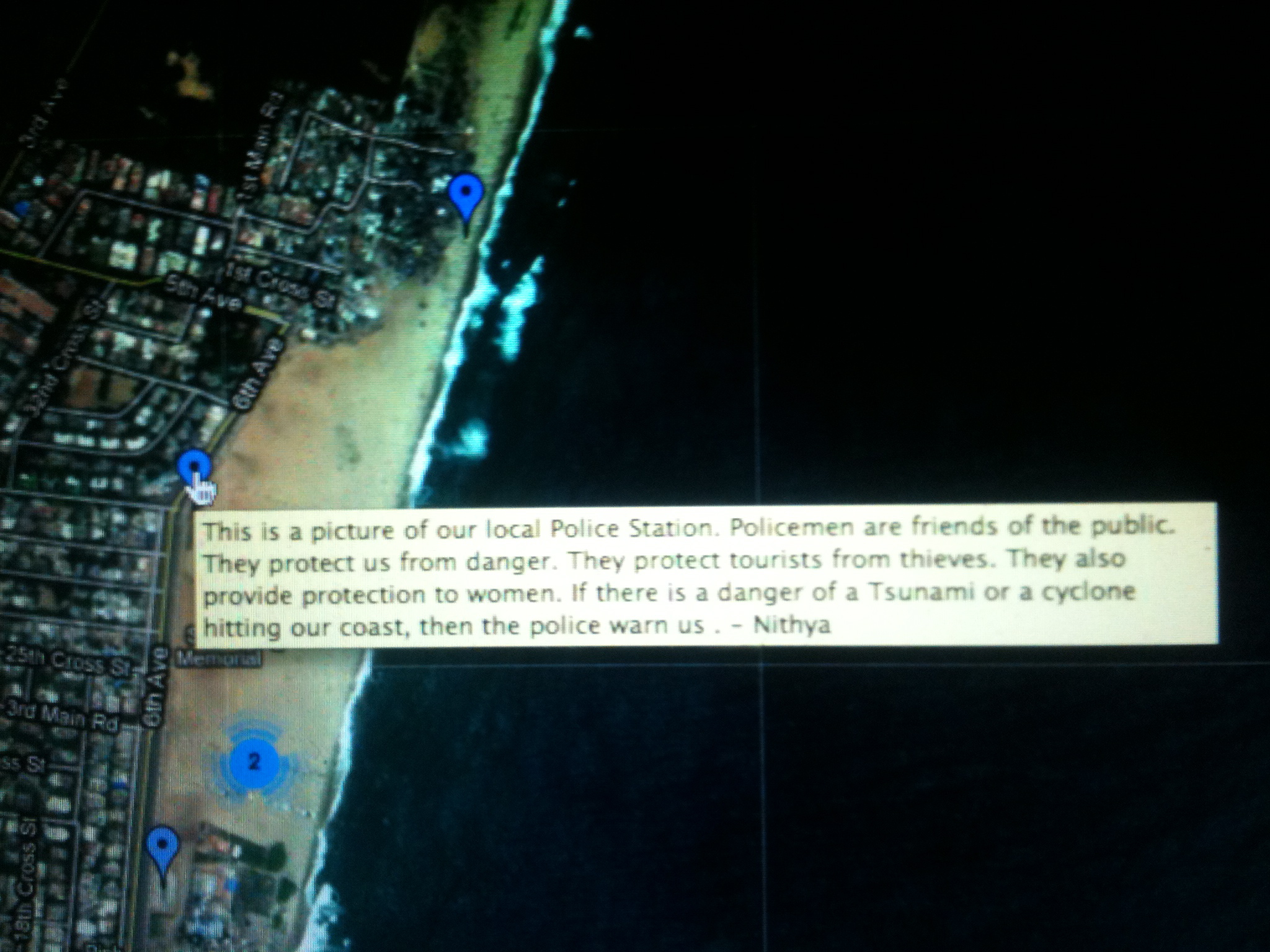
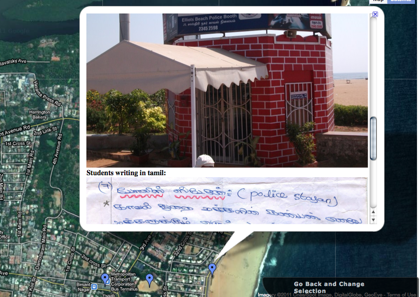
For me, the fact that maps are rhetorical tools became most visible during our mapping workshop in Olcott School where the kids debated constantly on what they would like on their map and how it should be represented, with each debate leading to subtle changes in the maps presentation. Also, in an effort to use maps as a tool to understand how the kids viewed their surroundings beyond their school, we gave them google images of the surrounding area and asked them to take pictures and write about what they found interesting in different areas. While the best way to have done this would have been to let the kids choose the areas themselves, unfortunately, because all the kids were not used to navigating using google images we familiarized them with the tool by marking places of interest and taught them to use roads and other identifiers to locate these areas. This is a quick screen capture of the areas that were marked. Placemarks marked 2 and 3 when clicked, reveal more locations.
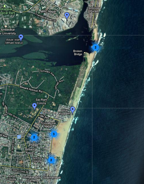
The resulting map tells us a story, and provides insight into how these children visualize these spaces.
If the placemark is clicked, it reveals the photo that was taken and the original writing in Tamil.
To look at all the photos along with what the kids said, please visit http://www.transparentchennai.com/buildamap/olcott.php
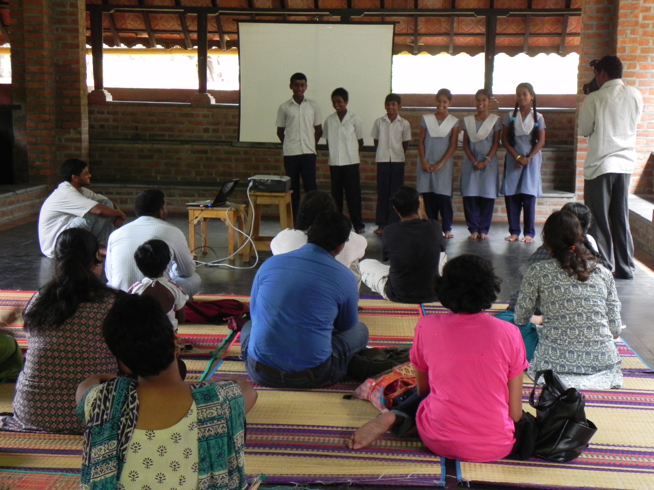
Finally these maps were used to tell the children’s story in a public presentation made by the kids.


What stories will the maps made by Urur and Olcott Kuppam tell? What conversations will they start between the Kuppam, the general public and the authorities? While we can’t know for sure, we do know that the maps will help in at least ensuring that these conversations are less one sided.
-Siddharth Hande
Indigenous people in Australia uses songs and paintings to map their country. Songlines are an example of traditional ways of recording paths across their land and navigating them.
yes and its brilliant!
Pingback: Transparent Chennai:Importance of Community Maps | Nepal Blogs
Just wanted to comment and say nice webpage, great to read from people with knowledge of this.
Thank you!